10 to 14 June 2019 / Lisbon, Portugal
For the third time, the training course ‘Using the Copernicus Marine Data Stream for Ocean Applications in Europe’ took place. This time the University of Lisbon, within the frame of H2020 PORTWIMS project, hosted the classroom phase.
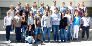
Sixteen participants from six different European countries joined the workshop. As in previous courses, most of the time was spent on hands-on working, during which the participants worked on mini projects they chose themselves. Most of the projects dealt with how Sentinel-3 OLCI ocean colour data can be used to generate time series of everything from cyanobacteria trends in the Baltic and harmful algal blooms off the Portuguese coast to chlorophyll patterns off the western Antarctic Peninsula. Many students also used SLSTR Seas Surface Temperature (SST) data to track eddies, monitor upwelling, map temperatures in relation to a hurricane path or compare with buoy data. Some students also used products that included seas surface height and wind speed.
On the last day of the course, all participants gave a presentation reporting about their experiences using the Copernicus Marine Stream and the results they achieved during the course.

