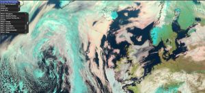
ePort is an application that allows the users to visualize and combine a range of satellite images with satellite derived products and numerical model fields. The Satellite images and products are mainly from EUMETSAT, but in some cases also from other satellite operators.
ePort has been developed within the EUMeTrain project (EUMETSAT), and it has been switched to a web map service in 2015.
In 2019 a new version of open ePort has been published under the name ePort JavaScript. This version uses plain HTML and JavaScript in its structure which allows faster browsing.
All images generated are automatically stored in an archive which makes it possible for users to do a qualitative research.
ePort is an excellent training tool principally meant for educators in meteorology within the European Meteorological Infrastructure (EMI) community!
The link to ePort website is EUMeTrain ePort (http://eumetrain.org/eport).
ePort Pro (requires Flash Player)
ePort (Javascript version, works with Mac)

