Non classé

44th EWGLAM & 29th SRNWP workshop

0 Comments

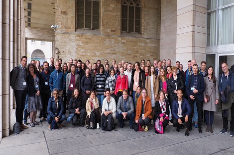
The 44th European Working Group on Limited-Area Modelling (EWGLAM) Meeting and the 29th Short Range NWP (SRNWP) Meeting were successfully organized between 26-29 September in Brussels, Belgium, with around 80 in-situ and 60 online participants and several invited speakers. The special topic this year was “Opportunities and challenges in hectometric NWP”. It was concluded that many hectometric NWP applications nowadays are focusing on urban environment. The most important challenges related to these models are adequate external parameters (e.g. land use database on the order of 10 m) and suitable physical parameterizations (e.g. 3D turbulence). A special session was also organized about the future evolution of High Performance Computing.

Presentations are available at the meeting’s website: http://srnwp.met.hu/Annual_Meetings/2022/index.html

EUMETNET convection-permitting ensemble database hosted at ECMWF

0 Comments

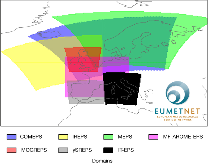
An archive of convection-permitting limited-area model ensembles of European countries has been established at ECMWF, as part of the cooperation within the SRNWP–EPS (Short-Range Numerical Weather Prediction – Ensemble Prediction System) project of EUMETNET…

For further information click on the link below:

https://www.ecmwf.int/en/newsletter/166/news/eumetnet-convection-permitting-ensemble-database-hosted-ecmwf


Saharan dust outbreak as observed by the E-PROFILE network

0 Comments

av-small


Click on the image to see the animation showing the dust plume over Europe


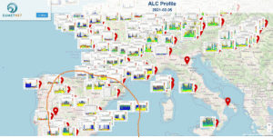
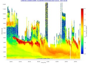
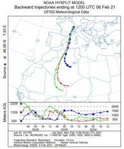
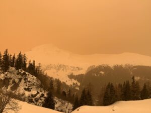
Over the weekend a strong outbreak of Saharan dust affected large regions of Europe and lead to number of photos as seen in Figure 1 with red-coloured skies and dramatically decreased visibility. Such conditions were observed by many ALC’s (Automatic lidars and ceilometers) in the E-PROFILE network, as illustrated in Figure 2. The origin of the air is clearly Saharian as indicated by the back-trajectories in Figure 3.

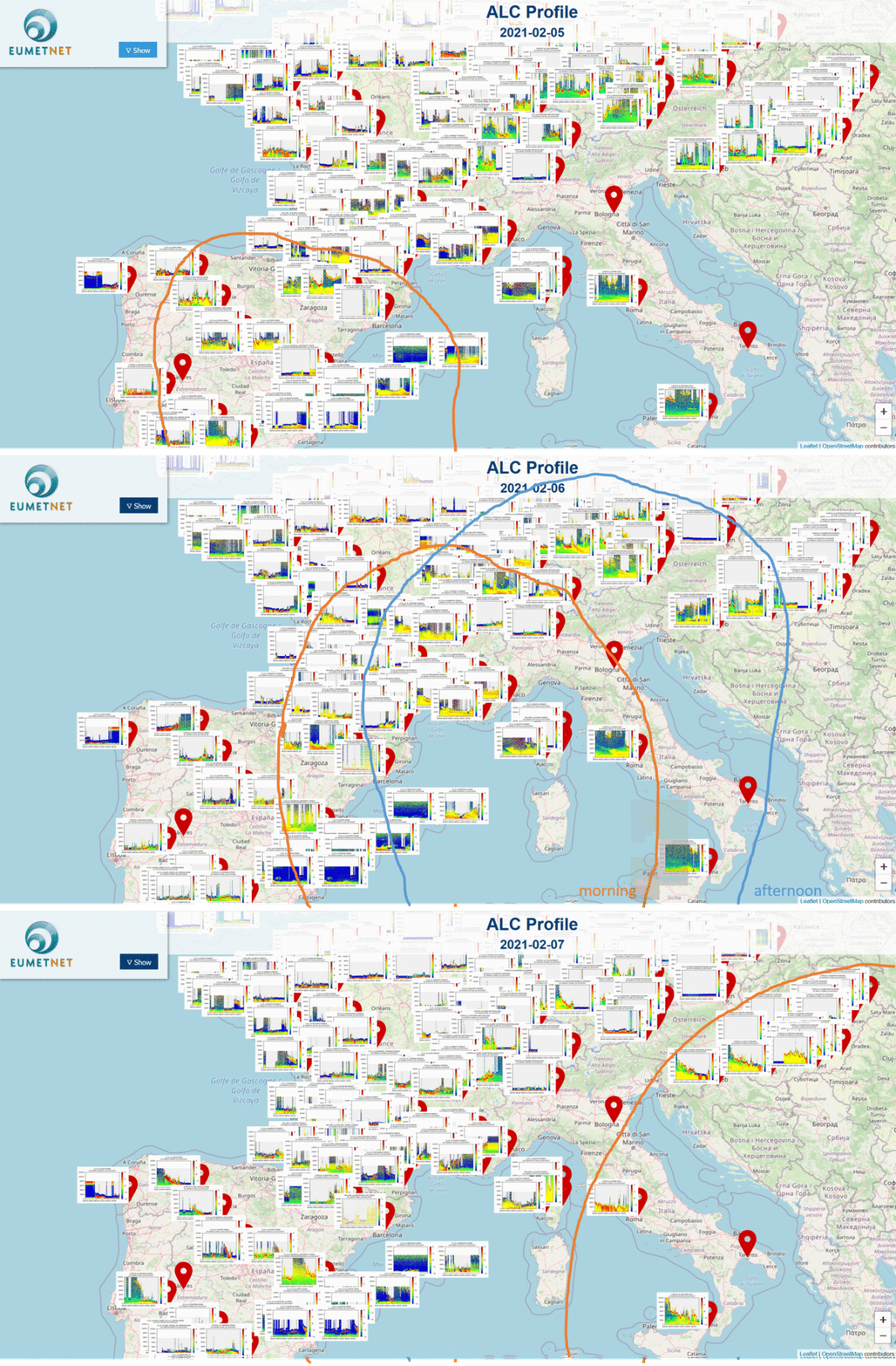
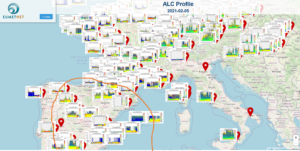
Dense 24/7 networks such as E-PROFILE are an ideal tool to monitor the horizontal, vertical and temporal distribution of aerosols and prove extremely useful to assess the situation in such events. This is illustrated by Figures 4-6 which indicate how the dust plume moved over Europe. It was located over Spain on 05 February before gradually moving towards the North and East during 06 and 07 February. This is a showcase for Saharan dust mixed into the boundary layer, but such a monitoring is possible for any aerosol type at any tropospheric altitude.

av-small

Fig.1 Strong limitation in visibility and atmosphere in reddish colours in the Swiss prealps. Picture taken by Alexander Haefele in the afternoon of 06 February 2021.


av-small

Fig.2 Attenuated back scatter observed on 06 Feb by the E-PROFILE ALC in Bern, Switzerland, in proximity to the location of the picture in Figure 1. A massive intrusion of Saharan dust reaching the boundary layer in the late morning can be observed.


av-small


Fig.3 Back-trajectories arriving in Bern, Switzerland on 06 Feb 12:00 for different altitudes. They clearly indicate the Saharan origin of the airmass. Data from HYSPLIT accessible at www.ready.noaa.gov.


av-small


Fig.4 Overview of attenuated backscatter profiles observed on 05 Feb at several central-European stations. The area delimited by the orange line denotes the area where high dust concentrations were observed. Interactive view at: https://e-profile.eu/#/?currentView=CMProfile&measurementDate=2021-02-05&QLSize=70


av-small

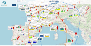
Fig. 5: Overview of attenuated backscatter profiles observed on 06 Feb at several central-European stations The area delimited by the orange and blue lines denote the area where high dust concentrations were observed during the morning and the afternoon, respectively. Interactive view at: https://e-profile.eu/#/?currentView=CMProfile&measurementDate=2021-02-06&QLSize=70


av-small


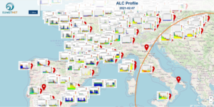
Fig. 6: Overview of attenuated backscatter profiles observed on 07 Feb at several central-European stations. The area delimited by the orange line denotes the area where high dust concentrations were observed. Interactive view at: https://e-profile.eu/#/?currentView=CMProfile&measurementDate=2021-02-07&QLSize=70


av-small

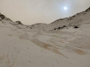
More images of the phenomenon in the Swiss Alps near Grand Saint-Bernard

av-small

Apple standard weather app & EUMETNET

0 Comments

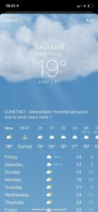
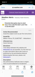
With its new update to iOS 14, Apple’s standard weather app now attributes EUMETNET and Meteoalarm as its source.

The app uses the Weather Channel, a company owned by IBM, whose weather systems use the Meteoalarm feeds.


Collaborative Forecasting for Aviation in Europe

0 Comments

Once again, this year, Operational Meteorologists at 12 national MET Providers will be taking part in the European Cross Border Weather Advisory procedure for EUROCONTROL Network Manager. The EUMETNET members producing the daily forecast output provides clear, and internationally consistent, information regarding the severity and probability of convective weather across the forecast domain; which has expanded further for 2020 and encompasses some of the busiest routes and sectors in Europe.

The procedure’s primary goal aims to increase EUROCONTROL Network Manager’s (NM) and participating ANSP’s (Airspace Navigation Providers) awareness of potentially significant convection that could disrupt the European Aviation network within the next 12 to 36 hours to support operational decision makers’ effective and efficient management of the network. However, this year, the cross-border weather procedure will also play an important role in ensuring that the recovery from COVID-19 is as delay free as possible. Traditionally weather is one of the major causes of capacity reduction across wide areas of the aviation network, so a collaborative approach to weather management will be vital to ensure its impact is reduced as much as possible as air traffic begins to increase.

Cumulonimbus (CB) clouds are the main meteorological phenomena that this forecast focuses on, primarily as CB clouds can be used as a proxy for possible ‘weather avoidance’. Weather avoidance is the unplanned movement or deviation off the original flight plan requested at short notice by pilots as a result of ‘weather’ ahead. The reason that pilots would want to avoid these cloud types is due to the hazardous conditions associated within them (e.g. severe turbulence, downdraughts, icing and lightning). Multiple avoidance requests will lead to additional workload and complexity for air traffic controllers, who are then unable to safely handle the ‘normal’ amount of traffic, and capacity of the airspace is affected. This ultimately can lead to the implementation of decisions and measures to help mitigate against this by ANSPs.

The service this year has a delayed start of 1 June (due to COVID-19) and will  run until to the end of September 2020.

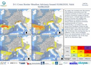
Example of a forecast

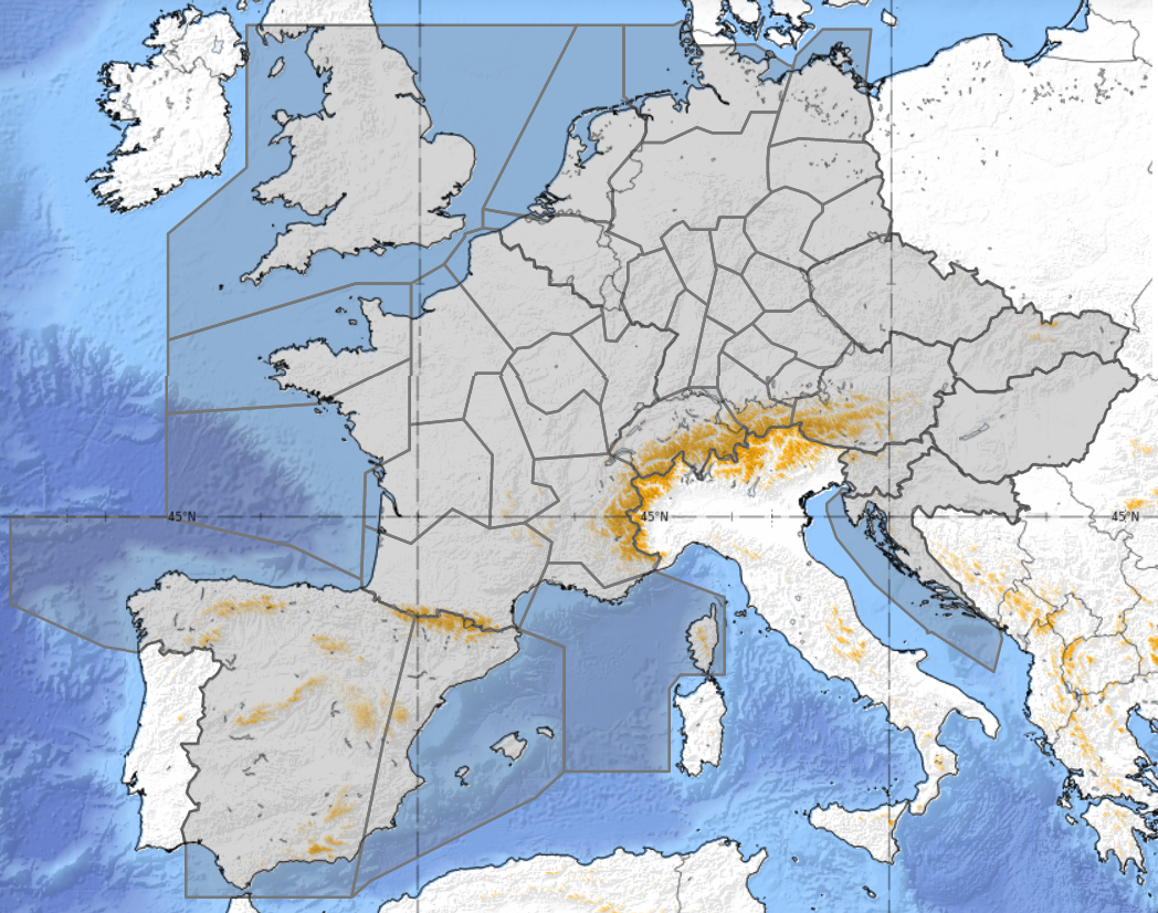
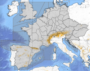
Forecast domain

WMO Press release regarding the impact of Covid-19 on observing systems

0 Comments

https://public.wmo.int/en/media/press-release/wmo-concerned-about-impact-of-covid-19-observing-system


ECMWF Webinars

0 Comments

ECMWF is organising a series of seminars given by international experts to explore aspects of the use of machine learning in weather prediction and climate studies. See below for further details:

Seminars to probe potential for machine learning in weather prediction


EMS Session on SRNWP

0 Comments

Find out more about the SRWNP session that will take place at the annual EMS meeting in Copenhagen.

EUMETNET_EMS2019

European Nowcasting Conference 2019

0 Comments

The third European Nowcasting Conference (ENC) is organised under the umbrella of the EUMETNET Nowcasting Programme and will be held at the headquarters of AEMET in Madrid from 24 to 26 April 2019. The goal of the conference is to promote recent advances in the theory and practice of nowcasting in Europe and other parts of the world. The conference welcomes participants from operational, research and forecast user communities to discuss methods for improving the quality of nowcasting in Europe. The scientific program will feature keynote addresses as well as contributed presentations and offer room for discussions.

More information on this conference can be found here: https://enc2019.aemet.es/

loading map - please wait...

Agencia Estatal de Meteorología 40.451200, -3.723930 Agencia Estatal de Meteorología C/Leonardo Prieto Castro 828071 - MadridSPAIN Tel. +34 915 819 882Send a mail: _

ENC 2017

0 Comments

2nd European Nowcasting Conference
3-5 May 2017
DWD, Offenbach

The 2nd European Nowcasting Conference (ENC), organised under the umbrella of the EUMETNET nowcasting project ASIST, was held at the headquarters of DWD in Offenbach, Germany, from 3 to 5 May 2017. Close to 100 participants from 24 nations presented their latest findings on observations, nowcasting techniques, verification, user aspect and combined nowcasting/numerical weather prediction. Besides the many excellent presentations, there was plenty of room for discussions during dedicated time slots at the end of each session as well as during poster sessions and coffee breaks.

To a large extent, observation and nowcasting techniques dedicated to convective phenomena were presented, indicating that thunderstorms and lightning are still one of the major themes in nowcasting. Furthermore, it could be noted that, even at individual national meteorological services (NMS), a wide variety of nowcasting systems and models are available which can lead to an overwhelming (and sometimes inconsistent) suit of nowcasting information available for forecasters. It is thus not surprising, that efforts towards seamless prediction systems, incorporating a multitude of nowcasting and NWP models, can be noted. While nowcasting is still tied to observations and their short-term extrapolation, the combination of nowcasting with NWP is gaining momentum as NWP systems with rapid update cycling are approaching the nowcasting domain.

While the conference gave an impressive view of the many efforts in nowcasting techniques, there currently still seems to be a lack of coordinated activities. Similar systems are developed in parallel at different research institutes or NMS’s and one might ask if a coordination of those efforts could be fruitful and result in widely accepted and applied nowcasting tools. Modelling consortia, such as those for NWP’s, are not yet existent for nowcasting. Possibly, such cooperation is difficult due to regional and observation specific characteristics as well as the end-user focused nature of nowcast-ing . In this heterogeneous and interdisciplinary setting, it is important that the EUMETNET nowcasting project ASIST continues to support the cooperation between nowcasting researchers and practitioners among NMS’s.

To see all the Posters and presentations made at the conference please click here.

Book of abstract: enc_book_of_abstract
Conference Programme: enc_program