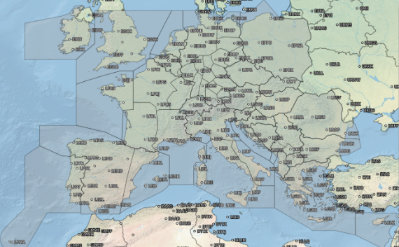
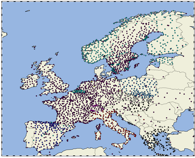
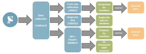
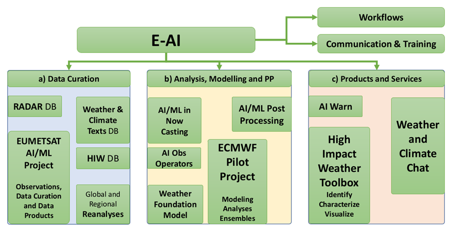
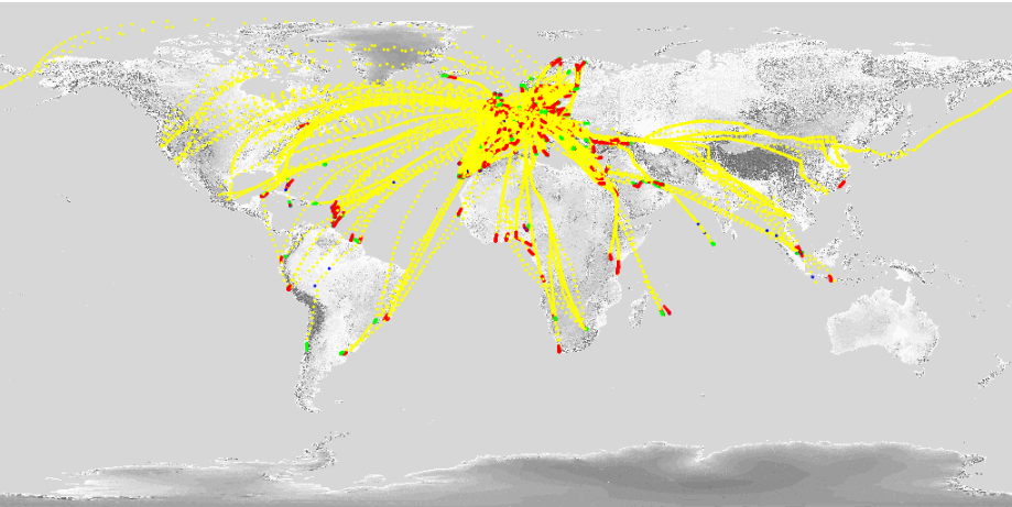
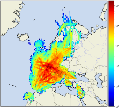
E-SurfMar & the Saint Malo “Route du Rhum”

E-SurfMar & the Saint Malo “Route du Rhum”

0 Comments

28th & 29th October – Discussion and Test with IMOCA racing boats for next year’s OceanRace

The EUMETNET E-SurfMar Programme collaborates with EUMETSAT, CLS and OceanOPS to deploy our drifting buoys.

The new phase of the programme requires us to deploy buoys in all oceans. We must therefore have at our disposal a panel of ships allowing us to optimize our deployments. With the help of OceanOPS we have established a strong link with the world of racing sailing, in particular with the Imoca class and more recently with the Ocean Race which will leave in January for a crewed round the world race.

To better understand the constraints of these racing boats, we went to Saint Malo for the “Route du Rhum”. This allowed us to meet the technical teams of ships that will deploy our buoys during the Ocean Race. Several limiting factors have been addressed to enable future deployments. We had with us a buoy from the programme allowing the crews to better understand our problems. We were also able to understand their questions. The Ocean Race, which is organizing its round-the-world trip, will make reinforced bags to allow our buoys to be moved safely during the race without damaging the ship, which is entirely made of carbon.

So we did tests on the ships. We were also able to communicate about our activities within the programme and explain to this community the importance of these buoys for weather forecasts.

Geneva DBCP (Data Buoy Cooperation Panel) 38

0 Comments

Within the framework of the DBCP, Olivier Desprez de Gésincourt, the manager of E-SurfMar and Christophe Guillerm, the manager of the work package data buoys,  went to Geneva for the DBCP 38 meeting (Data Buoy Cooperation Panel) that took place from 31st October to 4th November.

The purpose of this meeting was to meet our different partners face-to-face for the first time in person since COVID-19 and also to present the new Programme Management Team.

The Programme Manager presented his work and, in addition, work shops were organized on the following themes :

-Data management

-Anchored buoys

-Wave measurements

-Capacity building

-Environmental management

-Vandalism and Awareness

-GDAC


For the new E-SurfMar management team, this was a very relevant meeting to discuss and meet with colleagues, especially those at NOAA where an agreement is in place to be part of the GDP UPgrade programme.

We met Marc Lucas from CLS who manages the Trusted programme as part of WMO collegues from OceanOPS.

Finally, it was an essential opportunity for us to share and present our programme.

44th EWGLAM & 29th SRNWP workshop

0 Comments

The 44th European Working Group on Limited-Area Modelling (EWGLAM) Meeting and the 29th Short Range NWP (SRNWP) Meeting were successfully organized between 26-29 September in Brussels, Belgium, with around 80 in-situ and 60 online participants and several invited speakers. The special topic this year was “Opportunities and challenges in hectometric NWP”. It was concluded that many hectometric NWP applications nowadays are focusing on urban environment. The most important challenges related to these models are adequate external parameters (e.g. land use database on the order of 10 m) and suitable physical parameterizations (e.g. 3D turbulence). A special session was also organized about the future evolution of High Performance Computing.

Presentations are available at the meeting’s website: http://srnwp.met.hu/Annual_Meetings/2022/index.html

4th European Nowcasting Conference

0 Comments

The fourth European Nowcasting Conference (ENC2022) is organised under the umbrella of the EUMETNET Nowcasting Programme and will be held online from 21 to 25 March 2022. The goal of the conference is to promote recent advances in the theory and practice of nowcasting, very short range forecasting and seamless prediction in Europe and other parts of the world. The conference welcomes participants from operational, research and forecast user communities to discuss methods for improving the quality of nowcasting, very short range forecasting and seamless prediction in Europe. The scientific program will feature keynote addresses as well as contributed presentations and offer room for discussions.


More information about this conference can be found here: https://eumetcal.eu/en/Information/Tekstpagina?textpage=ENC2022

eGAFOR Integration into SkyDemon

0 Comments

eGAFOR (enhanced, electronic and European GAFOR) is a new graphical colour-coded forecast for general aviation (GA). It was developed by CCL (Croatia – the initiator and leading partner), ARSO (Slovenia), BHANSA (Bosnia and Herzegovina), OMSZ (Hungary), ROMATSA (Romania), SHMU (Slovakia) and SMATSA (Serbia and Montenegro) with Slovakian IBL as an industrial partner within the framework of an EU-funded project that was carried out between 2017 and 2021. Towards the end of the project, partners looked at how best to operationally issue eGAFOR once the project was over. This was difficult as there were multiple problems ranging from the procurement to the recognition of this new type of forecast by the aviation and meteorological community. The solution was found under the umbrella of EUMETNET and it was decided that the operational production and further development of eGAFOR products should continue as part of EUMETNET’s Aviation Support Programme (ASP). The participation in the ASP will also facilitate new members joining eGAFOR as there has already been interest from other aviation service providers.

General aviation is the most vulnerable part of aviation because it operates in the lower part of the atmosphere where the most hazardous meteorological phenomena occur. Although many GA pilots are experienced, there is a large number of less experienced pilots flying light aircraft without sufficient meteorological awareness. In addition to this, meteorological products for GA in Europe differ between the areas covered, timeframes, visualization and forecasting methods. However, the biggest issue is that they are not harmonized between neighbouring countries. Due to this lack of coordination in forecasts, meteorological phenomena can  seem to end at political borders, and this incongruity can reduce users´ confidence.

All of the above-mentioned reasons contributed to weather-related GA accidents with 392 fatalities over the past 10 years in Europe ( https://www.easa.europa.eu/newsroom-and-events/events/general-aviation-and-low-level-weather-seminar, the introductory presentation)

eGAFOR  is roughly based on traditional GAFOR (General Aviation FORecast), but with several improvements. Firstly, it is produced simultaneously and collaboratively in multiple countries, so users can see the forecast for a wider area on a single platform.  Before eGAFOR, when users were preparing a cross-border flight, they had to visit multiple web pages to collect meteorological data.

In addition, whilst traditional GAFOR is a deterministic forecast based on two meteorological elements, low clouds and visibility, eGAFOR is a probabilistic forecast of five elements (clouds, visibility, cumulonimbus clouds, turbulence and freezing precipitation). On top of this, eGAFOR is an interactive webpage accessible via www.egafor.eu, whilst traditional GAFOR is intended for printing.

Figure 1 eGAFOR forecast on www.egafor.eu webpage

SkyDemon is one of the best VFR (Visual Flight Rules) flight-planning and navigation software in the world, made by Divelements Limited, an independent software company based in the UK. SkyDemon was launched in 2009 and has been developing and advancing ever since.

The SkyDemon team recognized the problem of obtaining meteorological data for cross-border flights and therefore one of the features SkyDemon offers is meteorological data integrated into VFR planning charts. For that reason, SkyDemon integrated traditional GAFOR over the countries that provided the forecasts. Since the traditional GAFORs are produced per country, a lot of effort had to be invested in order to integrate different forecasts into a single one.

With the introduction of eGAFOR, SkyDemon took the opportunity to widen its network and to provide more meteorological data to end-users, general aviation pilots, to make their flight planning safer. However, since eGAFOR is in many aspects different from the traditional GAFOR, further development was required. There were various problems, different times of issuing, more forecasted phenomena, different visualization, to name a few. Once these problems were solved, eGAFOR was successfully integrated into SkyDemon:

Figure 2: Integration of eGAFOR into SkyDemon

Figure 3: An example of the integration of eGAFOR into SkyDemon: Austria is producing the traditional GAFOR, while Hungary is producing eGAFOR. Two different products are successfully harmonized.

This integration will help general aviation users in their cross-border flight planning between countries where eGAFOR is issued and countries where the traditional GAFOR remains

We hope this will benefit our end-users and make their flight planning easier, thus increasing their safety.

Further Information

Making of eGAFOR on YouTube

eGAFOR viewer

East Mediterranean Storm naming group names its first storm

0 Comments

Greece, Cyprus and Israel have formed the East Mediterranean Storm Naming Group.

Greece has named its first Storm ‘Athina’.

EUMETNET welcomes its new Executive Director

0 Comments

EUMETNET would like to welcome Klemen Bergant, who has taken over from Eric Petermann as the new Executive Director from 1st September.


“It is a great honour and responsibility for me to take up the post of Executive Director of EUMETNET and thus support members in developing their individual and joint capabilities in the fields of observation, forecasting, climate and aviation.”

Before taking up this new role, Klemen Bergant was at the Slovenian Environment Agency (ARSO) where he was the Director of the Meteorological Office from 2006 to 2017 and then Director of the Meteorology and Hydrology Office from 2017 to 2020.

During his time at ARSO, he was a permanent representative of Slovenia with the WMO (World Meteorological Organisation) and the Slovenian delegate at EUMETSAT (www.eumetsat.int) and ECMWF (www.ecmwf.int) Councils.

He also represented ARSO at the EUMETNET and ECOMET (www.ecomet.eu) Assemblies as well as in the ALADIN consortium for limited-area modelling and its Central European subgroup RC-LACE. He was EUMETNET Assembly’s Vice-Chair (2009 – 2013) and Chair (2013 – 2015), Chair of the Science and Technology Advisory Committee (2013 – 2015), and Chair of the EUMETNET’s Governance Task Team (2009 – 2010) that proposed the current structure of EUMETNET.


“Through the cooperation of national meteorological services with atmospheric and ocean observations in remote areas, efficient exchange and dissemination of data, coordination of forecasting and warnings, EUMETNET also helps its members to address the challenges of extreme weather events that are becoming more frequent and severe due to climate change.“ K. Bergant

Before joining the Slovenian Environment Agency, he was Head of the Centre for Atmospheric Research at the University of Nova Gorica, Slovenia, where he is still Adjunct Professor of Meteorology.

AutoPollen featuring in the EAACI Weekly Highlights report

0 Comments

The EUMETNET AutoPollen activity was featured in a report made at the Annual Congress of the European Academy of Allergy and Clinical Immunology – see link to report below:

Article “A new era…”


EUMETNET convection-permitting ensemble database hosted at ECMWF

0 Comments

An archive of convection-permitting limited-area model ensembles of European countries has been established at ECMWF, as part of the cooperation within the SRNWP–EPS (Short-Range Numerical Weather Prediction – Ensemble Prediction System) project of EUMETNET…

For further information click on the link below:

https://www.ecmwf.int/en/newsletter/166/news/eumetnet-convection-permitting-ensemble-database-hosted-ecmwf


Saharan dust outbreak as observed by the E-PROFILE network

0 Comments

av-small


Click on the image to see the animation showing the dust plume over Europe


Over the weekend a strong outbreak of Saharan dust affected large regions of Europe and lead to number of photos as seen in Figure 1 with red-coloured skies and dramatically decreased visibility. Such conditions were observed by many ALC’s (Automatic lidars and ceilometers) in the E-PROFILE network, as illustrated in Figure 2. The origin of the air is clearly Saharian as indicated by the back-trajectories in Figure 3.

Dense 24/7 networks such as E-PROFILE are an ideal tool to monitor the horizontal, vertical and temporal distribution of aerosols and prove extremely useful to assess the situation in such events. This is illustrated by Figures 4-6 which indicate how the dust plume moved over Europe. It was located over Spain on 05 February before gradually moving towards the North and East during 06 and 07 February. This is a showcase for Saharan dust mixed into the boundary layer, but such a monitoring is possible for any aerosol type at any tropospheric altitude.

av-small

Fig.1 Strong limitation in visibility and atmosphere in reddish colours in the Swiss prealps. Picture taken by Alexander Haefele in the afternoon of 06 February 2021.


av-small

Fig.2 Attenuated back scatter observed on 06 Feb by the E-PROFILE ALC in Bern, Switzerland, in proximity to the location of the picture in Figure 1. A massive intrusion of Saharan dust reaching the boundary layer in the late morning can be observed.


av-small


Fig.3 Back-trajectories arriving in Bern, Switzerland on 06 Feb 12:00 for different altitudes. They clearly indicate the Saharan origin of the airmass. Data from HYSPLIT accessible at www.ready.noaa.gov.


av-small


Fig.4 Overview of attenuated backscatter profiles observed on 05 Feb at several central-European stations. The area delimited by the orange line denotes the area where high dust concentrations were observed. Interactive view at: https://e-profile.eu/#/?currentView=CMProfile&measurementDate=2021-02-05&QLSize=70


av-small

Fig. 5: Overview of attenuated backscatter profiles observed on 06 Feb at several central-European stations The area delimited by the orange and blue lines denote the area where high dust concentrations were observed during the morning and the afternoon, respectively. Interactive view at: https://e-profile.eu/#/?currentView=CMProfile&measurementDate=2021-02-06&QLSize=70


av-small


Fig. 6: Overview of attenuated backscatter profiles observed on 07 Feb at several central-European stations. The area delimited by the orange line denotes the area where high dust concentrations were observed. Interactive view at: https://e-profile.eu/#/?currentView=CMProfile&measurementDate=2021-02-07&QLSize=70


av-small

More images of the phenomenon in the Swiss Alps near Grand Saint-Bernard

av-small